![[go to main index]](/notes/images/woodcut-sun-grey.jpg)
About
My company: Daring Plan publishes Selene, the fertility awareness iPhone app for serious women. Chart your cycles simply, powerfully, and beautifully. Selene supports the Fertility Awareness Method (FAM) and Natural Family Planning (NFP).
Get Selene now from the iPhone App Store!
Get Selene now from the iPhone App Store!
Recent Entries
Selene 1.0 Released!
Barney Glen Roald, 1943-2006
Night Watch
Life concentrate
¡Viva Mexico!
Terra Cognita
Heitur pottur
Hurry hard
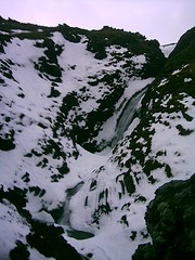
Pictures of Ice and Fire
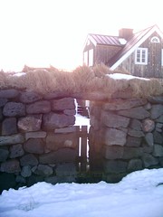
Winter in Iceland
Barney Glen Roald, 1943-2006
Night Watch
Life concentrate
¡Viva Mexico!
Terra Cognita
Heitur pottur
Hurry hard
Pictures of Ice and Fire
Winter in Iceland
Recent Books
The High Window, Raymond Chandler
The Little Sister, Raymond Chandler
The Big Sleep, Raymond Chandler
Practical Demonkeeping, Christopher Moore
Island of the Sequined Love Nun, Christopher Moore
Flashman, George Macdonald Fraser
Delta, R. E. G. Davies
The Pleasures of Slow Food, Corby Kummer
Flashman at the Charge, George MacDonald Fraser
Nothing But Blue Skies, Tom Holt
Archives by Date
October 2012
March 2006
February 2006
January 2006
December 2005
September 2005
August 2005
July 2005
May 2005
April 2005
March 2005
January 2005
December 2004
November 2004
October 2004
June 2004
May 2004
April 2004
March 2004
February 2004
January 2004
December 2003
November 2003
October 2003
September 2003
August 2003
July 2003
June 2003
May 2003
April 2003
March 2003
February 2003
January 2003
December 2002
December 2001
November 2001
August 2000
July 2000
May 2000
March 2000
February 2000
January 2000
November 1999
October 1999
September 1999
August 1999
May 1999
March 1999
Links
The Delta Green game
The SE Asia travelogues
The .Plan
Old home page
My company: Daring Plan publishes Selene, the fertility-tracking iPhone app for serious women. Chart your cycles simply, powerfully, and beautifully. Selene supports the Fertility Awareness Method (FAM) and Natural Family Planning (NFP).
My wife is creating Float Boston.
Search
Maintained with
Movable Type 2.64
Movable Type 2.64
(c) colin roald
1998-2003.